
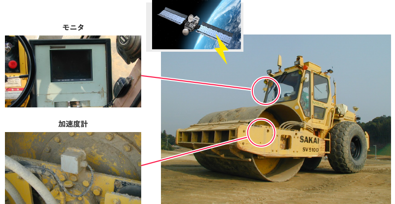
本システムは、位置座標を得るためのGNSS(Global Navigation Satellite System)と地盤剛性を得るためのCCV(Compaction Control Value)を併用することで、施工範囲全域の転圧回数と締固め状況をリアルタイムに取得し、表示するシステムです。 CCVは、振動ローラに取り付けた加速度計で計測される輪加速度波形を分析して得られる指標であり、地盤剛性を即時に表現できます。 当技術は、日本道路公団(現(株)高速道路総合技術研究所)・ハザマ(現(株)安藤・間)と共同開発したものです。
システム概要
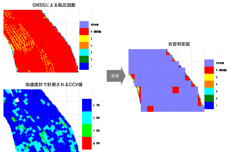
画面表示例
特長
- 施工管理の迅速化・精密化・省力化が可能です。
- 転圧面全域の品質管理が可能です。
- 大規模な盛土に威力を発揮します。